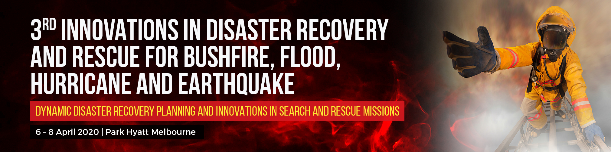
Agenda
| Time | Agenda | |
|---|---|---|
| Pre-Forum Drones & AI Technologies In Disaster Risk Management Site Tours | ||
| 09:00 – 12:00 |
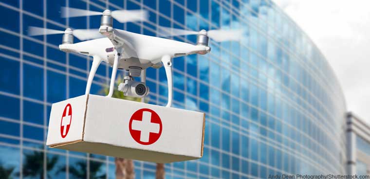
Using Unmanned Drones For Delivering Critical Medical Supplies And Searching For Victims |
|
|
When disaster strikes, one of the critical concerns is getting important relief goods such as medical supplies to those in need as swiftly as possible. However, when roads are unpassable, this becomes a tricky logistical challenge. Thus, the use of drones in delivering medical packages is nothing short of a brilliant idea. These drones can land in places that ground vehicles either cannot get to or take too long to reach. It can deliver life-saving treatment directly to the victims and at the same time give remote physicians eyes, ears and voice to instruct anyone on site. |
||
  |
||
| 14:00 – 17:00 |
Exploring Artificial Intelligence And Predictive Mapping In Disaster Risk Management |
|
|
Software algorithms are progressively generating important insights on a variety of phenomena. These software programs have also become so advance that they seemingly imitate human intelligence, hence the appropriate namesake artificial intelligence (AI). AI has had tremendous impact in managing disasters and planning out relief operations. It could be utilized to potentially predicting earthquakes to quickening recovery and response times, flood occurrences and even patterns in climate. Humanitarian groups are now also using AI to speed up map creation by using machine learning in computer software to extract objects such as buildings and roads from aerial images. |
||
Space In Each Site Tour Is Limited, Registrations Will Be Available On First Come, First Reserved Basis. |
| Time | Agenda | |
|---|---|---|
| 09:00 | Welcoming Speech, Opening Remarks & Thank You Sponsor Speech By Forum Producer |
|
| Building Advanced Prediction And Early Warning System For Natural Disasters With Connected Sensors, Big Data And AI | ||
| 09:15 |
City Of Los Angeles Bushfire Case Study: How To Predict Bushfire Patterns And Risks Using Connected Sensors And Big Data | |
| With climate change rapidly increasing the danger and scale of wildfires, the dry lands of California are particularly vulnerable. The state’s largest ever, the Thomas Fire, in December 2017, raged over 282,000 acres, destroyed a thousand homes, and threatened the lives of tens of thousands more. Yet in the midst of this aggressive firestorm emerged a surprising new tool to help the Los Angeles Fire Department monitor the fire and predict where it would go—and what it would do—next. WIFIRE is an integrated system for fire analysis. Using computational techniques including signal processing, visualization, modeling and data assimilation, the web-based platform merges satellite imagery and real-time data from cameras and sensors to assemble a picture of the fire, the conditions around it, and its trajectory. | ||
 |
Tony Nolan Community Fire Fighter and Data Scientist of The Minder Project NSW Fire and Rescue |
|
| 09:45 | How Google’s Advanced Machine Learning Algorithms Helps To Revolutionize Flood Prediction | |
|
For years Google has warned users about natural disasters by incorporating alerts from government agencies like FEMA into apps like Maps and Search. Now, the company is making predictions of its own. As part of a partnership with the Central Water Commission of India, Google will now alert users in the country about impending floods. These predictions are being made using a combination of machine learning, rainfall records, and flood simulations. Such warnings are particularly important in India, where 20 percent of the world’s flood-related fatalities are estimated to occur. |
||
 |
Ludovic Grosjean Principal Consultant OceanX Group |
|
| 10:15 | Morning Refreshments & Networking Session |
|
| Improving Evacuation With AI And Big Data | ||
| 10:30 |
Roundtable Discussion: Latest Innovative Technology For Disaster & Rescue Management |
|
|
||
 |
Anthony Frangi Founder Pop Up Radio Australia |
|
 |
Philip Lindsay Chief Superintendent Operational Communications Fire & Rescue NSW |
|
 |
Kenneth Murphy Project Director Fire & Rescue NSW |
|
 |
Andrew Short Assistant Commissioner Queensland Fire and Emergency Services |
|
| 11:30 | Improving Evacuation During Bushfire With CSIRO’s Award-Winning Decision Support System | |
| A bushfire evacuation tool created by CSIRO’s Data61 in collaboration with the Victorian Government and RMIT has won three Merit Awards at the 2019 iAwards. Held in Victoria, the Bushfire Evacuation Modelling program took home accolades in the Research and Development Project of the Year, Infrastructure and Platforms Innovation of the Year, and Community Service Markets categories. Described as a decision support system for bushfire evacuation, the platform assists emergency management organizations to assess evacuation and risk mitigation options for bushfires at a local, regional level and state level. The DSS (Decision Support System) addresses a significant gap in evacuation planning and danger reduction, specifically through the use of artificial intelligence to limit manual data gathering, a timely process that limits the number of scenarios that ultimately influence final decision making. The DSS allows local authorities and emergency services to explore a multitude of situations in a limited amount of time, whereas existing methods focused on validating decisions already made by an organization. While a significant number of software products can build evacuation plans, they lack the decision support capabilities provided by the DSS, and the capability to successfully translate designs to regional evacuations. |
||
| Fireside Chat: Thai Cave Rescue |
||
| 12:00 | Fireside Chat With Dr. Craig Challen On Thai Cave Rescue: Flashback On Emergency Response And Lessons Learnt |
|
 |
Dr. Craig Challen Cave Diver and 2019 Australian of the Year |
|
| 12:30 | Networking Luncheon | |
| Disaster Surveying And Mapping With Drones & LiDAR Technology |
||
| 13:30 | How Thai Cave Rescue Team Uses Advanced Mapping And Lidar Technology To Save Victims Trapped In Cave |
|
| Using advanced mapping and LiDAR technology, Nat Geo is able to digitally “drain” the water from the flooded cave system and provide a unique and enlightening perspective on the dilemma the rescuers faced. Nat Geo worked with the authorities in Thailand’s Department of National Parks to send a team into Tham Luang to conduct the first digital 3D survey of the cave system. The team used a laser scanning system that emits 400,000 beams per second to record reflections from the cave walls, enabling them to map the 1.5 mile span between the mouth of the cave and the pocket where the boys and their coach found themselves trapped as muddy monsoon waters flooded the cave. The extraordinary effort to produce Drain the Oceans: Thai Cave Rescue is the result of 8.7 billion data points from nearly 400 scans throughout a 3-week survey. The team also captured every crack and fissure of the cave system with more than 7,000 photos. To classify Harvey tweets, an AIDR classifier was trained (F1=0.64) using more than 30k human-tagged tweets collected from a number of past disasters. |
||
|
Dr. Craig Challen Cave Diver and 2019 Australian of the Year |
|
| 14:00 | International Case Study: Using Drones To Assess The Aftermath Of Indonesia’s Destructive Earthquake |
|
| The magnitude 7.5 earthquake that shook Sulawesi immediately flattened buildings and caused liquefaction, leading to mudflows in two neighborhoods in Palu (population 330,000) that ripped apart houses, swallowed roads and buried people alive. The National Agency for Disaster Countermeasure, or BNPB, turned to Team Rubicon Australia (TRA) for help. The nonprofit group is part of Team Rubicon Global, an international global disaster-response organization network powered by more than 80,000 well-trained volunteer military veterans who step in as first-responders to disasters worldwide. Once on the ground, the The TRA team used drones to take aerial photos and videos given the destruction and inaccessible landscape. Led by Richard Adams, a highly skilled drone pilot with extensive military and civilian UAV experience, the drone crew concentrated on four key areas: two neighborhoods in Palu that had suffered the most earthquake damage and two settlements that the tsunami struck. | ||
 |
Richard Adams Program Manager, Aviation and Intelligence Team Rubicon Australia |
|
| 14:30 | Searching For Survivors With Rescue Radar And Wireless Life Detector | |
 |
Ratindra Khatri Crisis, Emergency and Disaster Management Specialist SCDRR-Nepal |
|
| 15:00 | Afternoon Refreshments & Networking Session | |
| Innovative Approach To Deliver Critical Supplies In Disaster Response | ||
| 15:30 |
How Disaster Teams Are Using Temperature-Controlled Autonomous Drone Delivery System To Deliver Critical Medical Supplies |
|
| 16:00 | How Drones Are Used To Deliver Critical Lifesaving Flotation Devices During Flood And Hurricanes | |
 |
Duncan McLuckie Principal Flood Specialist NSW Department of Planning, Industry and Environment |
|
| Converging Information For Alert, Search & Rescue And Disaster Relief With Mobile Apps And Online Platform | ||
| 16:30 | Learning Lessons From Cyclone Debbie: How Crowdsourcing Intelligence Helps To Assess Damage Caused By Cyclone Debbie In Real Time | |
| When Cyclone Debbie slammed into the Australian coast in March 2017, Queensland State disaster recovery teams were better prepared than ever before to document, catalog and respond to the extensive damage it caused. Disaster recovery workers used the Gruntify mobile app, a cloud-based app to easily and quickly document storm damage. Using a mobile device, they only needed to snap a picture, fill out a text form, and submit the report with the tap of a button. The app transmitted the data to the Gruntify web platform, which was accessed by the state’s disaster center in a standard format, with geotagging information to precisely locate each incident. Gruntify systematically organized the data and kept information flowing smoothly to all relevant stakeholders, optimizing disaster response processes both during and after the storm. | ||
 |
Chris Quin Project Director Resilient Projects |
|
| 17:00 | The New Era OF Climate & Disaster Risk Information Capabilities | |
| The urgent need for next generation capabilities to support agile, strategic decisions in a rapidly changing world. | ||
 |
Jillian Edwards Founder and Principal Beyond Business as Usual |
|
| 17:30 | Q&A Session & Closing Remark by Forum Chairperson | |
| 17:40 | End Of Day Cocktail Networking Session | |
| After a long day of learning, benchmarking, and planning, unwind and mingle with your peers
|

| Time | Agenda | |
|---|---|---|
| Keeping Pulse In Disaster Response With Social Media Analytics | ||
| 09:15 | Translating Tweets Into Insights For Disaster Response | |
| CSIRO’s Emergency Situation Awareness (ESA) software detects unusual behaviour in the Twitter stream and quickly alerts the user when a disaster event is being broadcast. ESA also stores complete Twitter stream information and allows post-event analyses. Such useful and accessible information can provide timely situation awareness for disaster managers and emergency response agencies. ESA works by exploiting the statistical incidence of words used on Twitter to describe emergency events. It’s trained using historical word occurrences from past disaster incidents. This allows ESA to reveal emerging topics and flag them for investigation. | ||
 |
Ryan Vanderhorst Social Media and Content Specialist Bureau of Meteorology |
|
| 09:45 |
Identifying Evacuation Patterns Using Social Media Analytics | |
| In July 2018, a spark near the Mendocino National Forest ignited California’s largest wildfire on record. As the Ranch Fire spread rapidly, officials declared mandatory evacuations in several areas and counties. Analyzing evacuation and recovery patterns could help researchers understand how humans behave in the face of a disaster, which could inform emergency response efforts. Jia said nobody was able to provide population movements during a disaster, especially at a high temporal and spatial resolution—until Facebook manner. | ||
 |
Mark Tregellas Founder Crisis Cleanup Australia |
|
| 10:15 | Morning Refreshments & Networking Session | |
| Empowering Disaster Response Capacity With Robotic Technology |
||
| 10:30 |
Innovations In Cobots And Exoskeleton In Fighting Bushfires |
|
|
Bounding up numerous flights of stairs when the elevator is out is punishing enough for our legs and lungs, but imagine having to do so while carrying heavy equipment needed to extinguish a blazing high-rise fire. Such a scenario has prompted specialist vehicle manufacturer Trigen Automotive to work with Singapore’s Civil Defence Force to develop Auberon, a purely mechanical exoskeleton designed to take the strain out of carrying emergency equipment up to tower-top fires. Trigen says that the breathing apparatus, hose lines, nozzles, power tools and more which often make up a firefighter’s emergency toolkit can all add up to 40 kg (90 lb) of back-punishing weight, particularly when having to climb flights of stairs in a burning tower. Such equipment becomes much less of a burden when mounted to the Auberon Pneumatic Exoskeleton’s specially-designed frame. |
||
 |
Mark Cuthbert Advisor, Lessons and Evaluation Australian Maritime Safety Authority |
|
| 11:00 | Saving Flood Victims With Remote-Controlled Rescue Boat Emily | |
| Emily, which stands for Emergency Integrated Lifesaving Lanyard, is essentially a remote-controlled rescue boat. Since 2010, Emily robotic rafts have been used to rescue people. Thermal cameras can help Emily spot people in the water and slow down before arriving at their location, even turning itself the long way for an easier rescue. The idea is to make it possible for someone to call off the coordinates of a victim far away, and have a computer convert those — send them to GPS, to the robot, so that the robotic raft can arrive and help someone in the water, while the lifeguard can tend to people who need help elsewhere. | ||
|
Ludovic Grosjean Principal Consultant OceanX Group |
|
| Firefighting Drones | ||
| 11:30 | Fireside Chat: Are Firefighting Drones The Answer? | |
|
||
 |
Joe Urli President & Chairman ACUO – Australia Certified UAV Operators (Invited) |
|
| Overcoming Network Failures During Disasters With Innovative Technology | ||
| 12:00 | Championing Innovation With Serval Mesh – An Emergency Communication Network | |
| An Adelaide-designed app enabling mobile phone users to communicate even if their networks fail has won international acclaim at the Pacific Humanitarian Challenge. Dr Paul Gardner-Stephen of Flinders University created the Serval Mesh app so people in disaster-struck areas could continue to communicate among themselves. Serval Mesh utilises Bluetooth and wi-fi to transfer encoded messages between neighbouring phones hosting the app. Primarily, data in the form of SMS, maps and other text files can be moved across the network. If a direct link is available between phones, a phone call can be made. Dr Gardner-Stephen said the initial concept was to provide emergency communication systems when traditional phone towers were damaged. | ||
 |
Paul Gardner-Stephen Founder and CTO, Serval Project, Senior Lecturer Flinders University |
|
| 12:30 | Networking Luncheon | |
| Strengthening Australia’s Disaster Preparedness And Resilience | ||
| 13:30 | Understanding The Australian Disaster Preparedness Framework In Practice | |
The Australian Disaster Preparedness Framework supports Australia to develop the required capability to effectively prepare for and manage severe to catastrophic disasters The framework encompasses the following areas:
|
||
 |
John Gawne Advisory Board Member Powerline Bushfire Satety Program Department of Environment, Land, Water and Planning Managing Director Resilient Services Pty Ltd |
|
| Ensuring Transparency And Accuracy For Disaster Relief Support With A Secure Blockchain System | ||
| 14:00 |
Case Study Of Red Cross Boosts Disaster-Prone Communities With Blockchain ‘Cash’ |
|
|
The technology allows slum dwellers and rural villagers with simple mobile phones to effectively create their own local currencies to bootstrap development. |
||
 |
Tristan Cole Co-Founder Sempo |
|
| Assessing A City’s Vulnerability To Earthquakes With AI And Big Data | ||
| 14:30 |
How AI And Big Data Helps City Councils To Identify Earthquake Vulnerability In Cities And Prepare For Emergency Evacuation |
|
|
Detecting seismic vulnerability in urban areas is critical. Identifying high-risk buildings can save lives and help prioritize retrofitting investments. However, sending large teams of surveyors into the field is time consuming and expensive. Instead, this case study leverages imagery from satellites and drones, and street-view images from 360° street cameras to identify homes that are a high risk for collapse during an earthquake. Digital elevation models from satellite imagery helped identify buildings located on steep slopes, which are at higher risk for mudslides. A combination of satellite and drone imagery helped identify rooftop material, suggesting underlying construction techniques which are more vulnerable to seismic activities. The availability of street-view imagery is unique, as it can be used to identify soft-story constructions which are vulnerable to seismic activities. This case study is a good example of how different physical factors of vulnerability can be extracted from various data sources and the unique capabilities of street-view imagery. The deep learning algorithm trained on the street-view imagery caught 85% of the buildings which were flagged by expert engineers as vulnerable. |
||
| 15:00 | Afternoon Refreshments & Networking Session | |
| Enhancing Training For Disaster Preparedness With AR/VR Technology | ||
| 15:30 |
How Virtual Reality Helps Train Fire Fighters In Handling Emergency Responses During Searing Bushfires |
|
 |
Pradeep Khanna Executive Director, Asia Pacific VR AR Association |
|
| Telemedicine Empowered By 5G Network In Disaster Emergency | ||
| 16:00 | Successfully Implementing Disaster Preparedness, Response And Resilience Plan | |
|
||
 |
Jelenko Dragisic Executive Officer Greening Australia Training |
|
| Pioneering Innovation In Disaster Response Mission | ||
| 16:30 | Using 3D Printing To Deliver Critical Spare Parts And Medical Equipments During Disaster Relief | |
| As you step into World Vision’s Innovation Lab, there are dozens of things that might catch your attention. The buzz of a 3D printer whirring in the corner, a giant blackboard decorated with sketches, or the quiet focus of the teams dotted around the room. What might not catch your gaze is a seemingly simple, yellow pipe fitting resting on a desk. It looks basic enough; a ring made of hard plastic. But it actually symbolises something much bigger, both for communities affected by the Nepal Earthquake and the future of disaster responses around the globe. This pipe fitting is a new, tailored solution for earthquake-damaged water systems in Nepal. Its creation has been made possible because of the 3D printing expertise of Field Ready, a start-up aid group. In the past, a damaged water pipe in Nepal would be repaired by community members using makeshift solutions, such as wrapping a plastic bag over the leak. But today, this new fitting is delivering a much more secure and sanitary solution for leaking pipes. More importantly, it’s showing what’s possible when local and international innovators and active local communities have the chance to collaborate. | ||
|
Ratindra Khatri Crisis, Emergency and Disaster Management Specialist SCDRR-Nepal |
|
| 17:00 | Utilization Of Helicopters For Flood Rescue And Reconnaissance | |
 |
Shannon Crofton Vice President, NSW SES Volunteers Association Leading Firefighter, Fire and Rescue NSW |
|
| 17:30 | Q&A Session & Closing Remark by Forum Chairperson |